Back لفتا Arabic لفتا ARZ Lifta Czech Lifta (palästinensisches Dorf) German لیفتا Persian ליפתא HE Lifta ID Lifta NB Lifta Polish Lifta Romanian
Lifta
لفتا Lefta | |
|---|---|
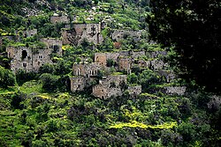 Deserted homes on the hillside | |
| Etymology: Lifta, personal name[1] | |
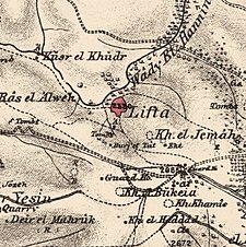
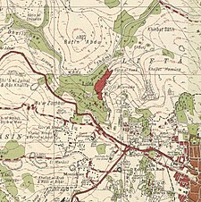
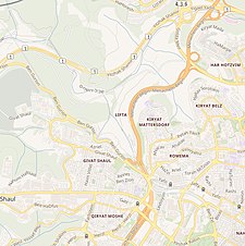
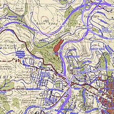
A series of historical maps of the area around Lifta (click the buttons) | |
Location within Mandatory Palestine | |
| Coordinates: 31°47′43″N 35°11′47″E / 31.79528°N 35.19639°E | |
| Palestine grid | 168/133 |
| Geopolitical entity | Mandatory Palestine |
| Subdistrict | Jerusalem |
| Date of depopulation | January 1948[2] |
| Repopulated dates | 1948–2017 by Jews |
| Area | |
| • Total | 8,743 dunams (8.743 km2 or 3.376 sq mi) |
| Population (1948[3]) | |
| • Total | 2,958 |
| Cause(s) of depopulation | Military assault by Yishuv forces |
| Current Localities | Western suburb of Jerusalem |


Lifta (Arabic: لفتا; Hebrew: ליפתא) was a Palestinian Arab village on the outskirts of Jerusalem. The village was depopulated during the early part of the 1947–1948 civil war in Mandatory Palestine.
In July 2017, Israel declared Lifta (called Mei Neftoach) as a national nature reserve.[4] It has been referred to as the "Palestinian Pompeii".[5]
- ^ Palmer, 1881, p. 322
- ^ Morris, 2004, p. xx, village #363
- ^ Palestinian Central Bureau of Statistics Archived 12 February 2012 at the Wayback Machine also gives village area
- ^ Cite error: The named reference
Naturereserve2017was invoked but never defined (see the help page). - ^ Palestinian ‘Pompeii’ in Jerusalem could face demolition
© MMXXIII Rich X Search. We shall prevail. All rights reserved. Rich X Search
